
Contact Treks and Trails India
Categories
Recent Posts
Archives
- November 2024 (2)
- September 2024 (1)
- July 2024 (1)
- April 2024 (3)
- August 2023 (6)
- May 2023 (1)
- April 2023 (1)
- March 2023 (16)
- February 2023 (6)
- January 2023 (8)
- December 2022 (3)
- October 2022 (5)
- September 2022 (2)
- August 2022 (3)
- July 2022 (8)
- September 2021 (1)
- August 2021 (3)
- July 2021 (3)
- June 2021 (8)
- May 2021 (2)
- February 2021 (1)
- September 2020 (14)
- August 2020 (8)
- July 2020 (13)
- June 2020 (13)
- May 2020 (9)
- April 2020 (4)
- March 2020 (7)
- February 2020 (9)
- January 2020 (1)
- December 2019 (1)
- November 2019 (8)
- October 2019 (6)
- September 2019 (15)
- August 2019 (8)
- July 2019 (13)
- June 2019 (15)
- May 2019 (2)
- April 2019 (4)
- March 2019 (1)
- February 2019 (1)
- January 2019 (15)
- November 2018 (1)
- October 2018 (71)
Tags
adventure (3)
Best guide for Rajasthan Tourism (3)
Camping (3)
camping mumbai (3)
camping pune (2)
camping tips (3)
first-timer (3)
Goa Watersports (3)
guide (3)
harihareshwar (3)
india (5)
Joy of giving (2)
Kalavantin Durg (4)
Kalsubai Peak (2)
Leh Ladakh India (6)
Lohagad Fort Trek (3)
nature (4)
olive ridley turtle (3)
photography (4)
planning (3)
Prabalgad Fort (3)
Prabalmachi Camping (2)
Rajasthan Tour (3)
Sandhan Valley (3)
Sandhan Valley Trek (2)
team building (3)
team building activity (3)
things to do (3)
Tiger Safari (4)
Top sights in Leh (3)
Top ten reasons to visit Rajasthan (3)
travel (4)
Trekking (4)
Trekking Pole (2)
Trek The Himalayas (3)
turtle festival information (5)
velas blog (3)
velas turtle festival (6)
velas turtle festival 2018 dates (5)
velas turtle festival 2018 from pune (5)
velas turtle festival 2018 review (4)
velas turtle festival 2019 (5)
velas turtle festival 2019 dates (4)
velas turtle festival reviews (5)
velas turtle festival video (5)
Banasura Hill Trek
Banasura Hill
After the Sahyadri Mountain Ranges in Maharashtra, the extended mountain ranges of the Western Ghats found in Kerala. Kerala is home to some of the tallest peaks in the Western Ghats. Trekking through these mountains has a different essence all in all. One such trekking experience you shouldn't pass up is the Banasura Hill Trek. The hill got its name after Banasura, one of the mythical characters in the Indian folklore. Set up at a challenging altitude of 6,600 feet. The conical-shaped Banasura is the second highest peak between Nilgiris and Himalayas. Banasura nestled in Wayanad, which beholds Chembra Peak and Pakshipathalam. Before trekking up the Banasura Hill, one has to obtain prior permission from the North Wayanad Forest Division office at Mananthavady. Banasura Sagar dam an important landmark near the trek.

Banasura Trek Information
Starting point: Vythiri, Wayanad
Trek gradient: Moderate. Banasura is a continuously uphill trail with some rising and falling segments.
Approximate time: This Trek is a two-day activity. 4 to 5 hours to ascend and 3 to 5 hours to descend, overall 9 hours
Trekking distance: 18 km (both-ways)
Water sources: One should carry at least 2 liters of water before starting the Trek, there are numerous streams on the trail
Best months to visit: Recommended to Trek during the winter months. The best months are September to January as, during heavy monsoons, the trail becomes mucky and slippery, which makes the descent difficult, and the weather is too humid during summers.

How to reach Banasura Hill Trek
Getting to Banasura Hill
- By Road: Mananthavady is the nearest town; Banasura is 25km away from here
- By Rail: 79 km from Calicut Railway Station
- By Air: 92 Kms from Calicut Airport
From Bangalore to Banasura Hill Trek
One can start from Bangalore the previous night, arrive at Kalpetta in the morning, concluding the Trek, and return to Bangalore on the same day.
- Drive from Bangalore to Kalpetta, Wayanad
- Distance covered: 288 km
- The average time it takes is 8 hours
Other Options to reach Banasura Hill Trek from Bangalore
- One can travel from Bangalore to Kalpetta (Wayanad), via the NH 212, but keep in mind that you will have to pass through a stretch of the highway that resides within the Bandipur Tiger Reserve and has night traffic ban between 9 pm to 6 am.
- From Bangalore, one can likewise take the way to Mysore to Sulthanbathery or Mananthavady.
- There is likewise an alternative of taking the late-night transport (Karnataka/Kerala RTC) from Mysore Road Satellite bus stop. Alight at Kalpetta on the next day early morning by 8 am.
- There is another option to board a night bus to Calicut from Bangalore. Alight at Kalpetta stop, which will be at around 7.30 am.
- On coming to Kalpetta, take ST transport to Padinjarethara, which is 18 Kms from here. (Kerala State Transport transports will be accessible from 6.00 am at Pinangode junction).
- From Padinjarethara, take an auto to Kappikulam, which is 5 Kms from here.
From Kozhikode to Banasura
- If you are going from Kozhikode, one can take the Thamarassery–Lakkidi Ghat road, a segment of NH 212 that links south of Kozhikkode and rest of Kerala with Wayanad.
- Lakkidi to Banasura is 45 km. When you reach Lakkidi, drive up 10 km to Vythiri and go left to Padinjarathara Road through the Banasura dam. Then to point to Vellamunda to Punlinjal to Banasura Hill.
- Several state public transport buses operate between Vythiri and Wayanad. One can take the bus from Vythiri to Wayanad and then continue with a taxi to reach the spot from Wayanad.
Banasura Trekking Trail
The trekking trail begins close to the forest office. Make sure that you start no later than 6.00 am. It's a 4 to 5-hour trek, one-way. The forest office commands that a designed guide ought to be with you during the Trek. The expense charged is Rs.500/ - The charge for trekking and authorization can be checked at the forest office. It differs as indicated by the number of hours you desire to Trek.

About the Banasura Trek
The Trek up to the Banasura hill is well-marked pretty much till the highest point. The path prevalently twists through the Shola forests. The outline of Banasura, which is an enormous cone-like hill, can be witnessed from the base. The Banasura Falls bends off into a murmuring stream and wanders over rocks and stones and underneath the abundant vegetation. The Banasura Sagar Dam Wayanad, the biggest earth dam in India and the second biggest of its sort in Asia, is another point where one can start the Trek. The beginning point of the climb is 2.5 Kms from the Banasura dam Wayanad. You can trek to the Meenmutty waterfalls, a 30–45 mins trek from the Forest Office (beginning stage of the Banasura Hill trek). The Meenmutty falls cascades are the biggest and the most excellent waterfalls in Wayanad. The 1000 foot cascade is well known for its three-layered course zone.
The ascent to the head of the hill is challenging. The trekking trail slithers through moving fields that cover the valleys. The grandness of the Shola forests is at peak at a few sections during the Trek. The bewildering sight of the Karamanathodu tributary of the Kabini River from the trail keeps on getting better. The three-hour ascent to the top is both energizing and challenging as the path is undulating and steep simultaneously. The course is steep right from the start, and it is difficult for 45 minutes. Individual sections of the Trek loaded with leeches and prickly-thick shrubberies, so they have to walk through them cautiously. Mid-way, you can spot 3-4 incredible mountain streams; you can fill your water bottles there. Post the steep climb; it's a steady ascent for the following 1.5 hours. This area is especially lovely since you get the opportunity to trek along with the moving fields that have a yellowish hue. The grass is knee-high, and the trail additionally has rocks and boulders. The magnificence of the territory is the highlight.
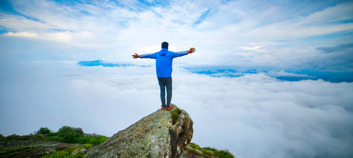
The last one km stretch is steep, and one may feel dried out since there is no tree spread. There are rock faces from where you can get an all-encompassing vista of the mountain ranges. Keep on strolling along the path; there are a few hillocks on the way to the pinnacle. The peak is the ideal vantage point where you are blessed to receive stupefying perspectives on the whole landscape. The mountain ranges reach out to the extent that the natural eye can see. Wayanad Banasura dam is the top trekking destination in Kerala.
Getting Back:
Follow the same route and descend along the same course. It'll take about 3 to 4 hours to get down since it's a nine kilometer stretch twisting through thick brambles, mountain streams, prairies that are knee-high and inclines that are at an edge between 60 to 70 degrees. On the off chance that you start the Trek by 6 am, the odds of coming back to the base around 4 pm are high, with the goal that you can begin towards Bangalore and cross the Tiger Reserve stretch before 9 pm and arrive at Bangalore by 1 am in the first part of the day.

Highlights of the Banasura Trek
- Walkthrough different landscapes like meadows level sloppy ways and thick backwoods trails
- Offers an entrancing beautiful perspective on the Wayanad Mountain Ranges of Western Ghats
- The Banasura Hill Trek is an energizing opportunity for trekkers who need harmony among isolation and experience.
- Experience the delight of trekking amid the flawless fields of the Shola timberlands.
- Witness the Banasura Sagar Dam is India's biggest earth dam and the second biggest of its sort in Asia.
- The short Trek to the Meenmutty cascades is a special reward. It is the most significant and most excellent cascade in Wayanad.
- Visit the excellent Banasura Hill Resort at the base deemed as Asia's biggest mud shelter
- An extraordinary trek for nature aficionados one can see and hear in abundance that the flying creatures, butterflies, and creepy crawl here.
- The whole Banasura district in the Nilgiris ecosphere, including the property, goes under the UNESCO World Heritage goal.

Support Info
We are available 24x7 Mon-Fri
Terms & Conditions
Contact Info
43 Nawanagar ICI Shed Ground Floor, Dockyard Rd, Ekta Nagar, Mazgaon, Mumbai, Maharashtra 400010
The payment is encrypted and transmitted securely with an SSL protocol.
We are available 24x7 Mon-Fri
Online booking system by | © 2018 Treks and Trails India